 |

|
|
|
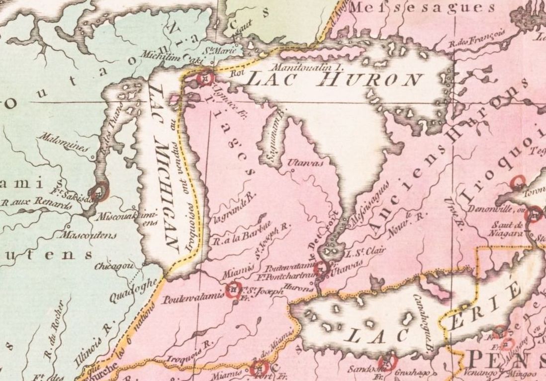
French Colonial Period (1620s - 1760) The place now known as Lapeer County was inhabited by the Fox and Sauk Tribes, when French explorers, missionaries and traders first set foot on the Michigan lower penisula, some time between 1620 and 1634 (depending on who you ask!). For reference, the Pilgrims on the Mayflower landed in Plymouth, MA in 1620.
The combination of the St Clair River, Lake St Clair, and the Detroit River, form a navigable strait between Lakes Huron and Erie. The population of early Michigan was concentrated along this strait, with the esception of the settlement at Michilimackinac, at the northern tip of the lower penisnsula. Migration into the interior was slow, partly because the peninsula was thought to be mostly swamp and forest, unfit for cultivation. Fort Detroit was established by the French in 1701. It was an important outpost for the French colonists until it was surrendered to the British in 1760, after the Fall of Quebec. Thus ended the French colonial period in Michigan. At that time the population of Detroit was about 2,000. The future Lapeer County lay 40 to 70 miles to the north, uninhabited but surely not unexplored by Europeans. | |
English Colonial Period (1760-1783)
The
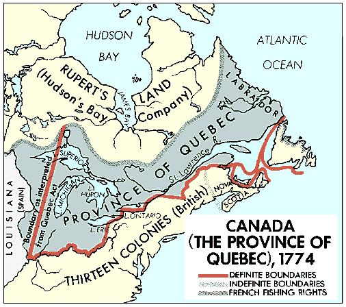
Quebec Act of 1774 added a large area, including what would Fort Detroit played a major role in the American Revolutionary War. When the War ended in 1783, Michigan came under US jurisdiction, but the US didn't take control until 1796. | |
American Territorial Period (1783 - 1837) It's hard to say when the British Colonial Period ended and American Territorial Period began in Michigan. The region was ceded to the United States in the 1783 Treaty of Paris, but the British were still determined to hold onto Fort Detroit, and the US didn't take over until 1796. Between 1783 and 1805 the lines drawn on maps did not always reflect the situation on the ground. Michigan was officially part of the Northwest Territory, from 13 Jul 1787 until 1 Mar 1803, when it briefly became part of Indiana Territory. Detroit was destroyed by a fire on 1 Jul 1805, but was soon rebuilt. Michigan Territory, including what is now Wisconsin, Iowa, Minnesota, and parts of the Dakotas, was formed on 30 Jun 1805, with Detroit as the capital, just 19 days after the fire.
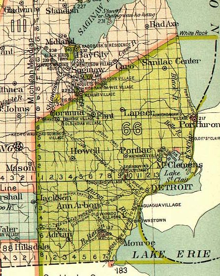
This 1896 map shows the part of Michigan, in green, that was ceded
to the US in the 1807 Treay of Detroit. In the Treaty of Detroit, signed on 17 Nov 1807, the Ottawa, Chippewa, Wyandot and Potawatomi Native American nations ceded to the United states a large part of southeast Michigan and northwest Ohio. This included the future Lapeer County. It's not clear what, if anything, the Indians got from the treaty. Detroit was captured and held for a short time by the British in the War of 1812. The county governments started to be organized in the Detroit area and in Mackinac (then called Michilimackinac) at the northern tip of the lower peninsula. Wayne County, which included Detroit, was organized in 1815. Monroe County, on the southwest side of Wayne, was founded in 1817, and Macomb County, on the northeast side of Wayne, in 1818. Also in 1818, Michilimackinac County, to the north. Oakland County, on the west side of Macomb, was founded in 1819, and St Clair County, northeast side of Macomb, in 1820.
In the Treaty of Saginaw, signed on 24 Sep 1819, Native American tribes ceded another large part of Michigan, to the north and west of the previous cession, to the US. The map above seems to include Lapeer County in the 1807 Cession, but [HRP, p. 10] indicates that only a small portion of Lapeer and Genesee were in the 1807 cession, and the rest in the 1819 cession.
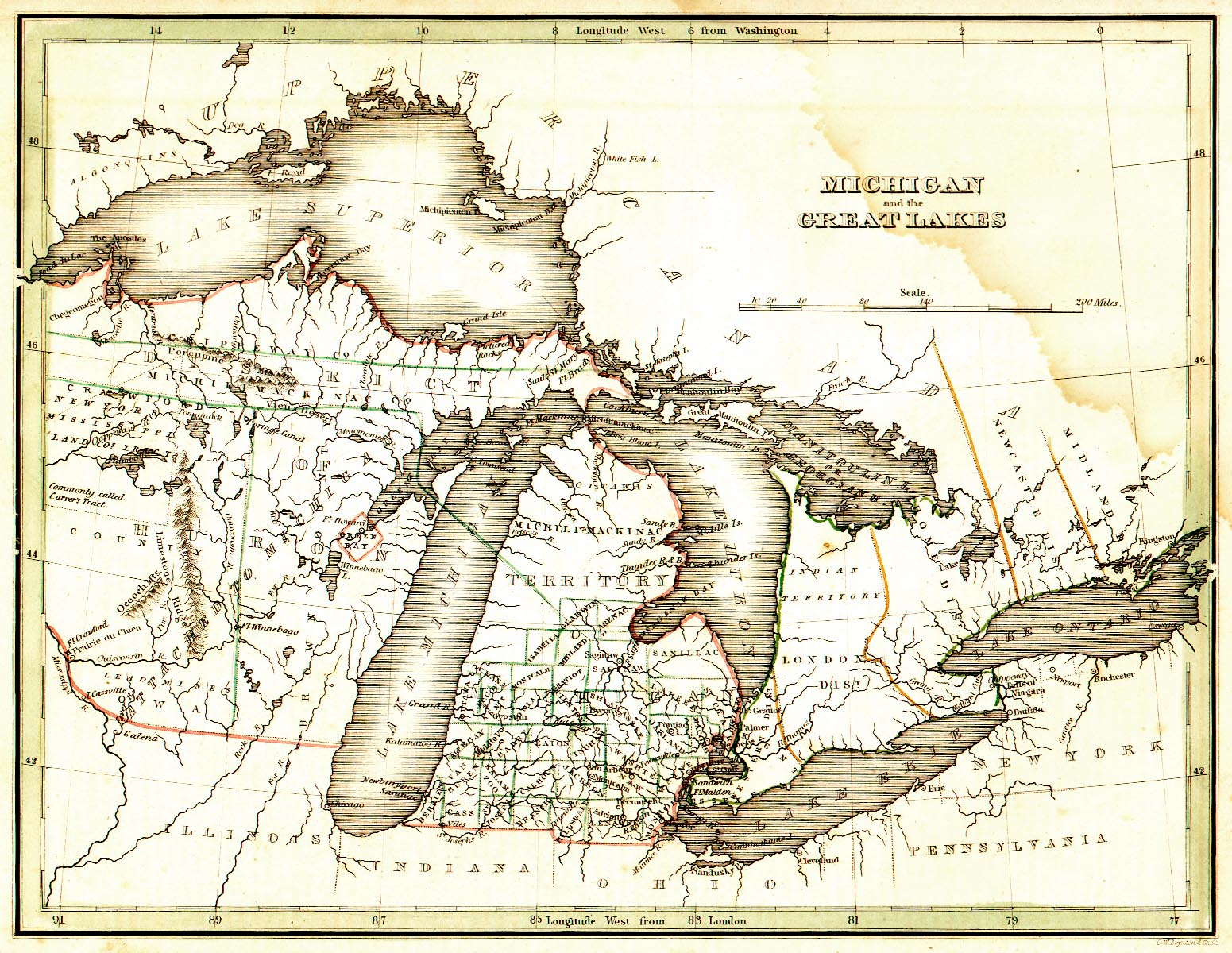
By 1818 some of the land had been surveyed, and a wagon road was laid out from Detroit to Chicago. On 10 Sep 1822, about 200 years after the first Europeans set foot on Michigan soil, there were 10 new counties created in Michigan Territory, including Lapeer. The boundaries changed a few times, before taking the present shape.
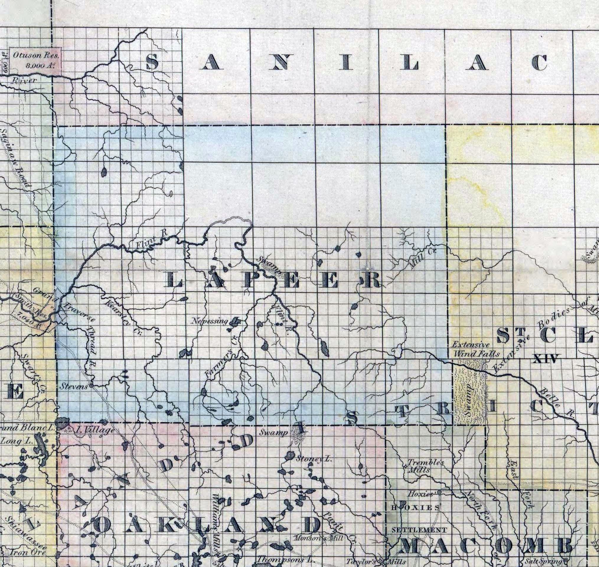
1826 map of Lapeer County, MI and surrounding area. Lapeer County lay uninhabited from its formation in 1822 until 1828, when the first settler, James DENEEN, settled in the southeast corner, in what is now Almont Township. He was the only inhabitant until 1830, when more settlers started to come in. The county government was finally organized on 2 Feb 1835.
| |
Michigan Statehood (1837 - present) Michigan bacame the 26th state in the United States on 26 Jan 1837. Most of the population was concentrated in the southeast, near the Detroit River.
| |
|
Also see the Census page, with a summary of the 1840 US Census for Lapeer County, and the Early Churches page. Main resource: [HRP] History of Lapeer County, Michigan : with illustrations and biographical sketches of some of its prominent men and pioneers (1884) by H. R. Page |
|
This page was last revised 14 Dec 2019 by William Haloupek.
Lapeer County MIGenWeb contents have been willed to MIGenWeb. |