
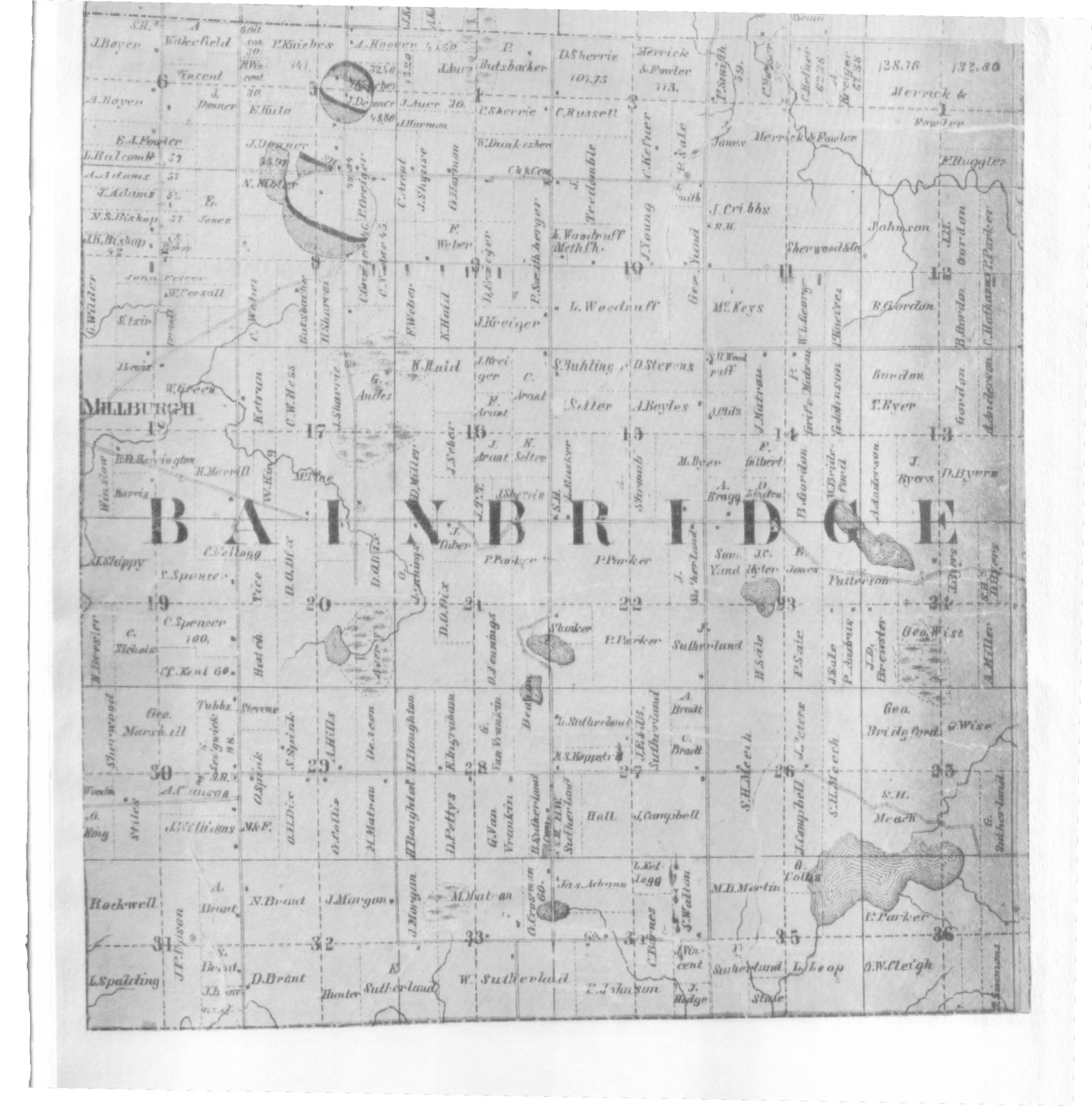
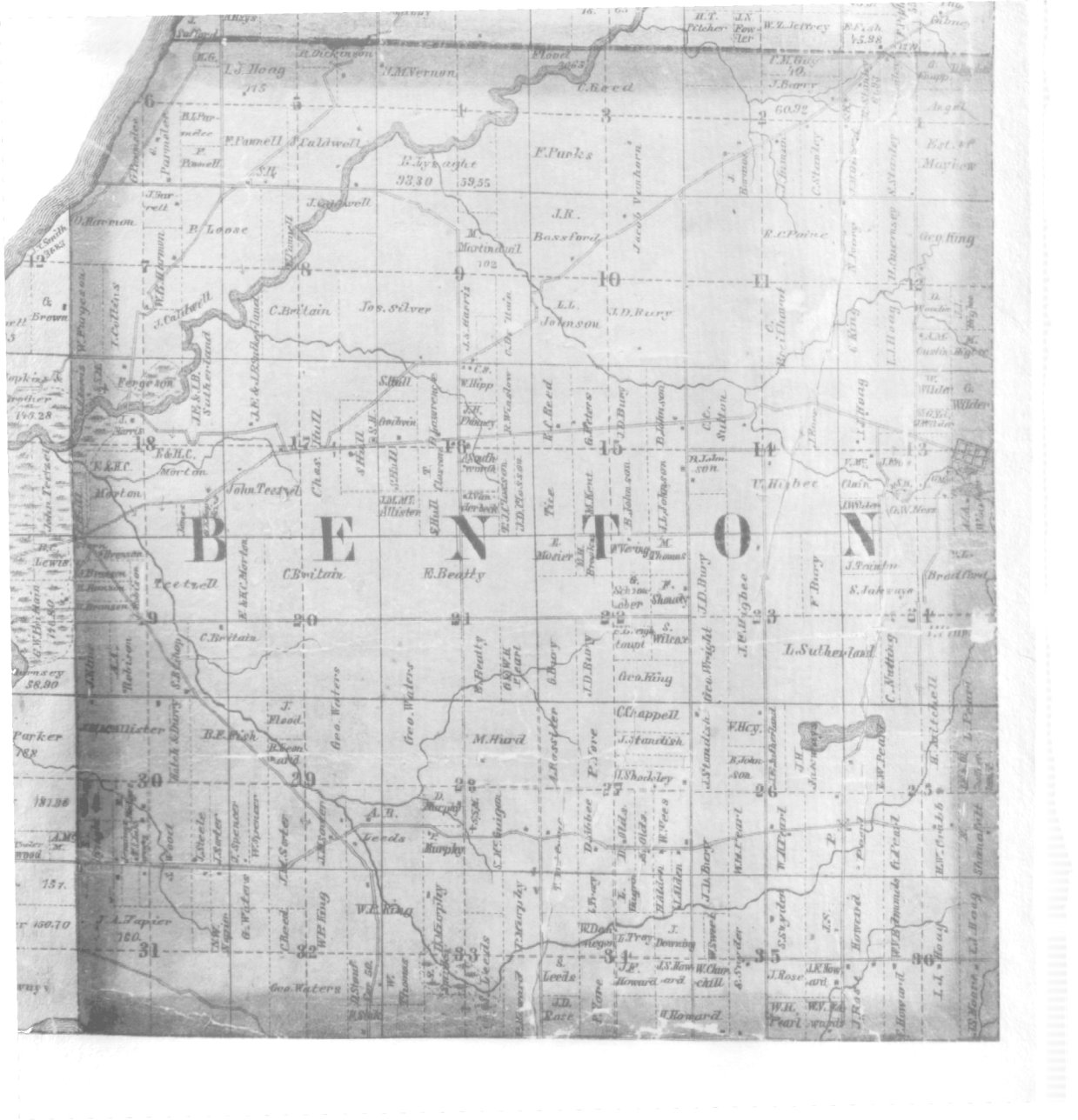
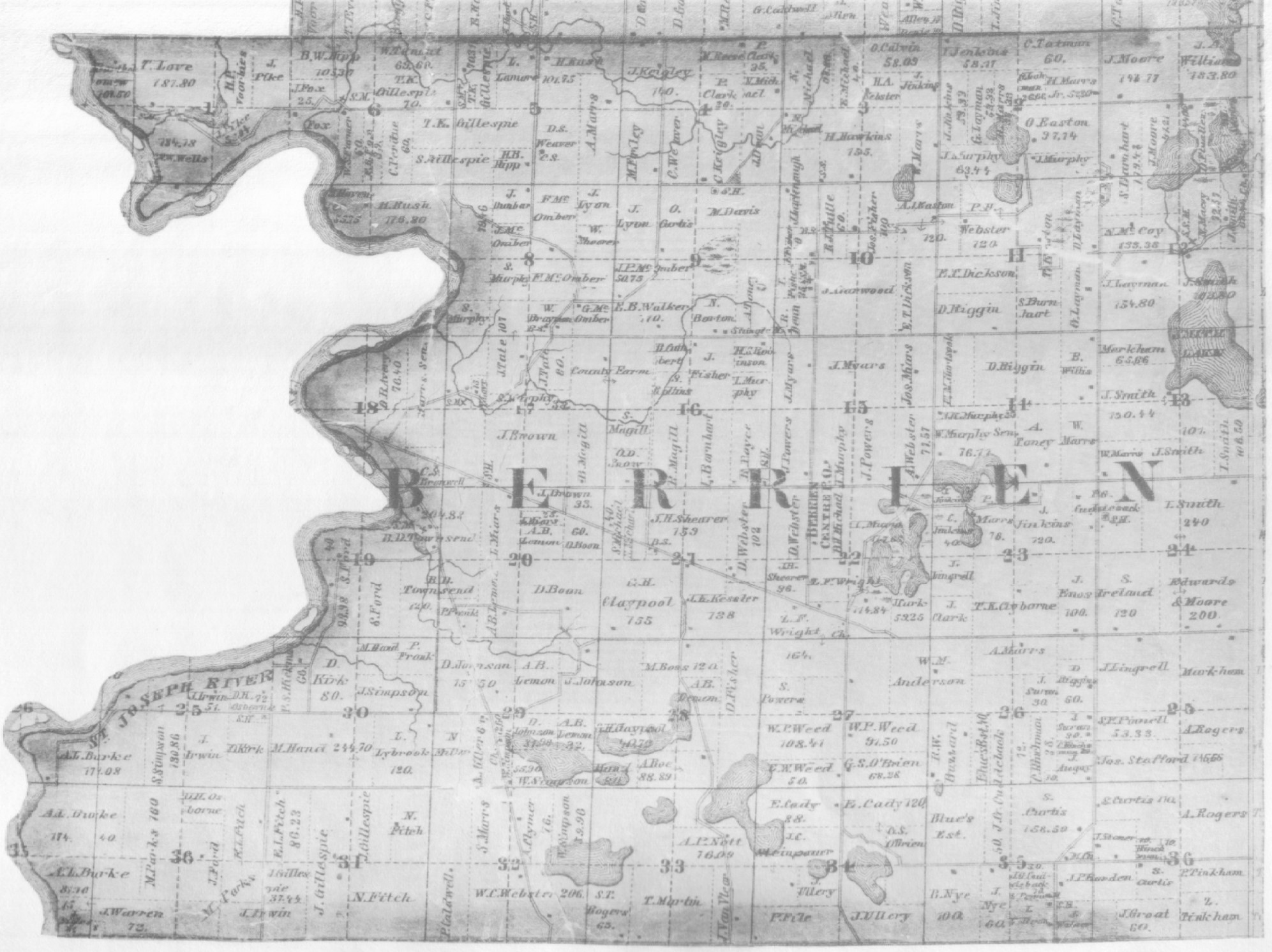
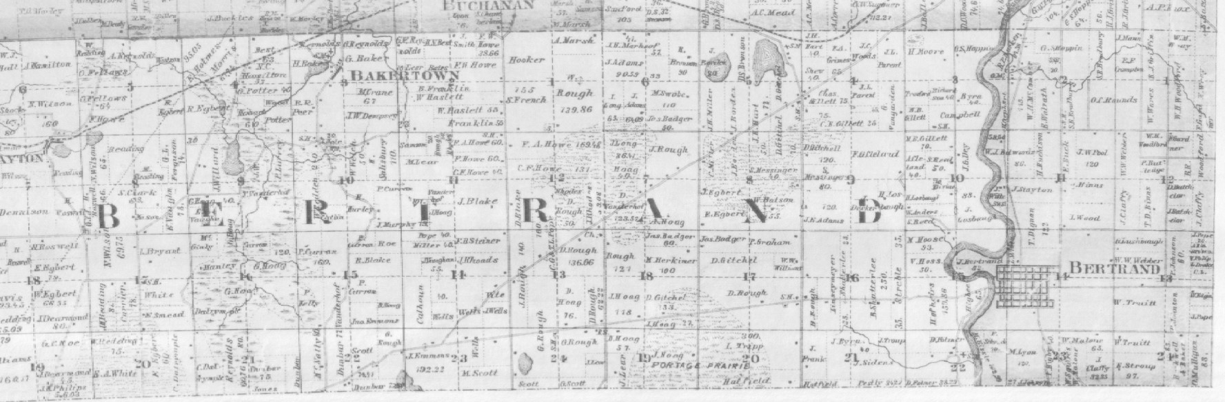
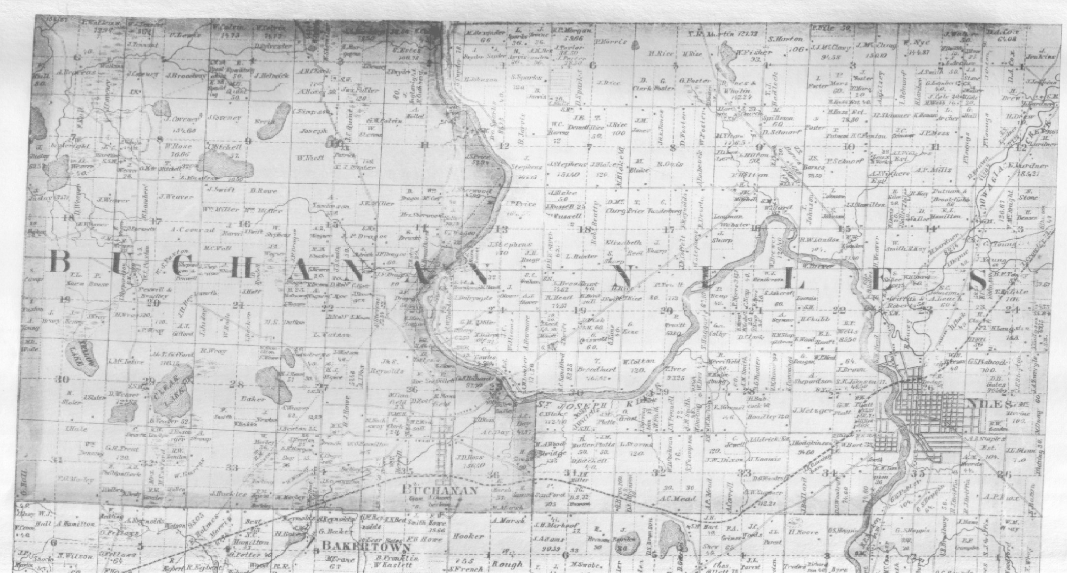
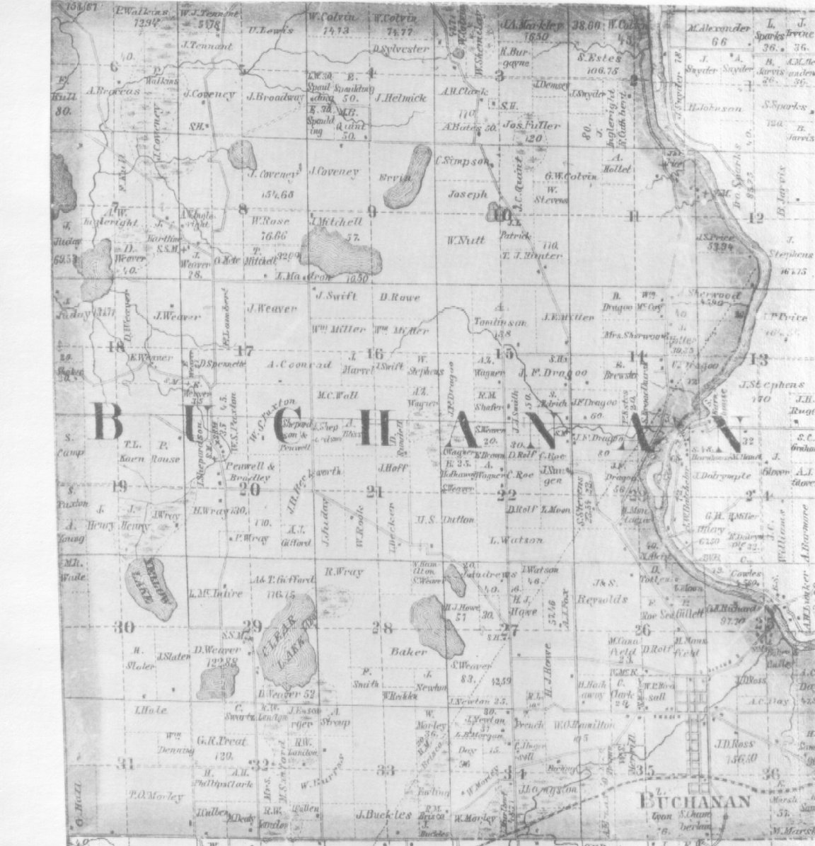
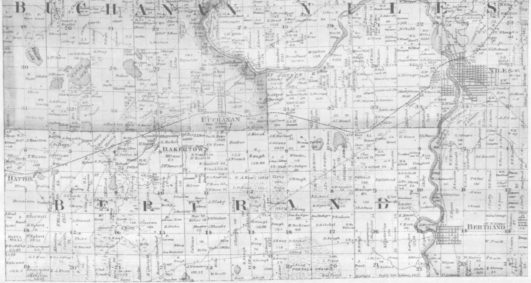
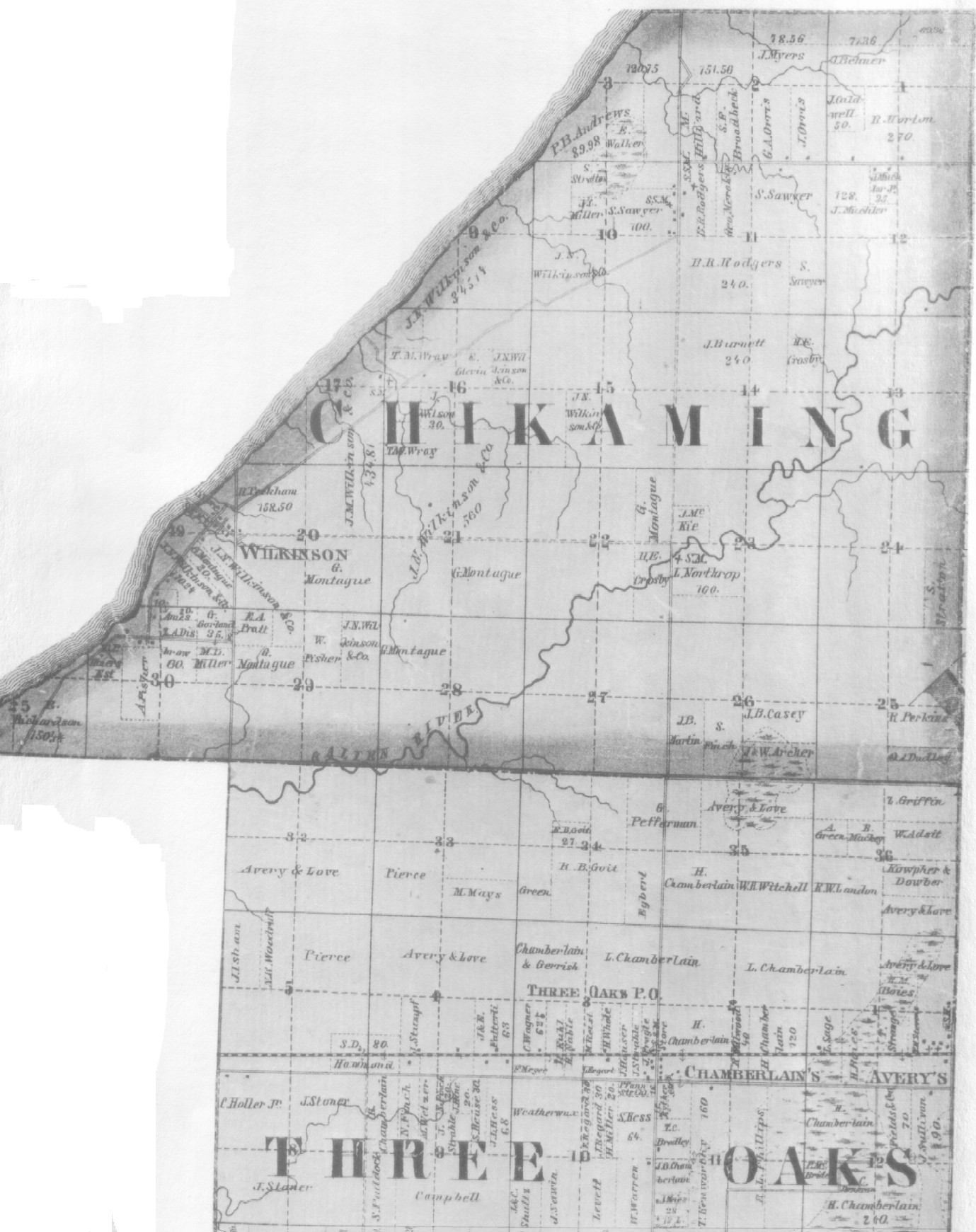
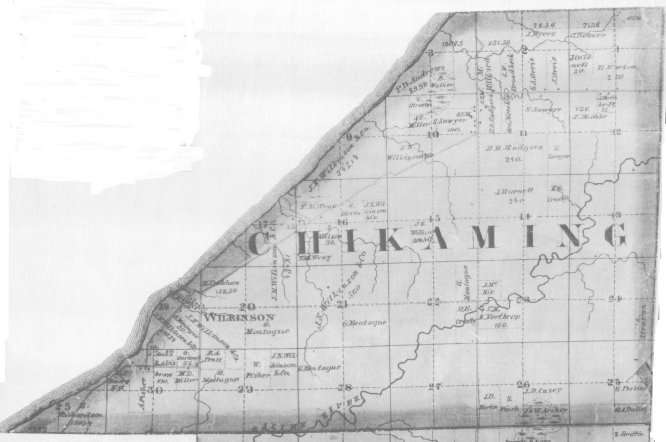
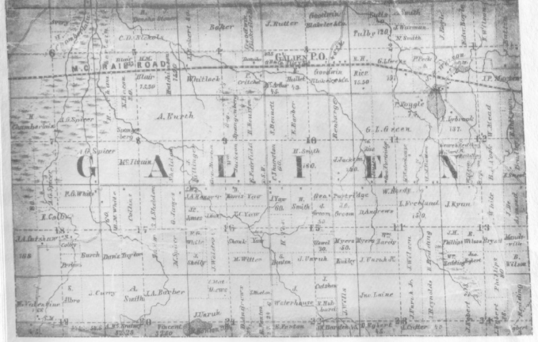
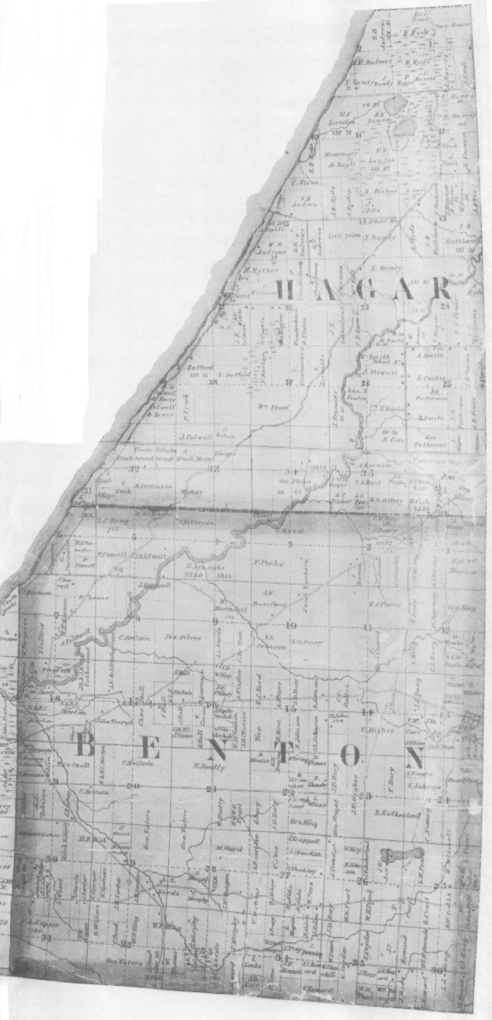
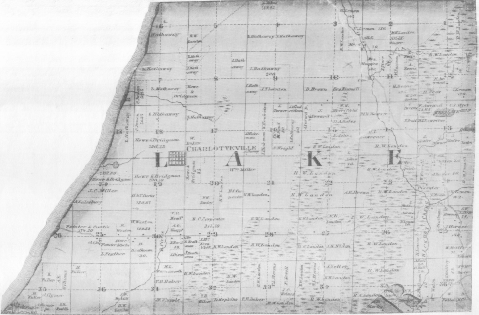
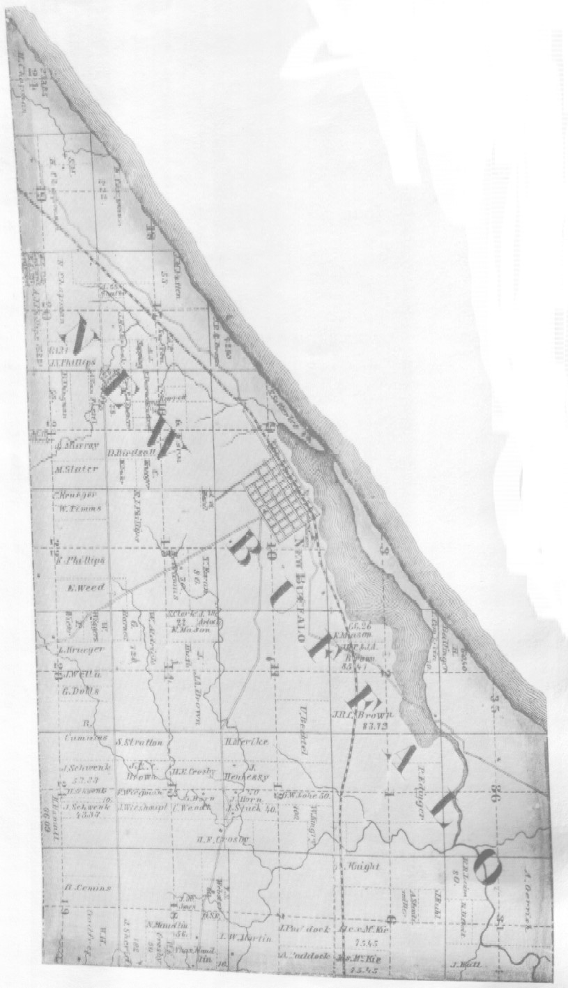
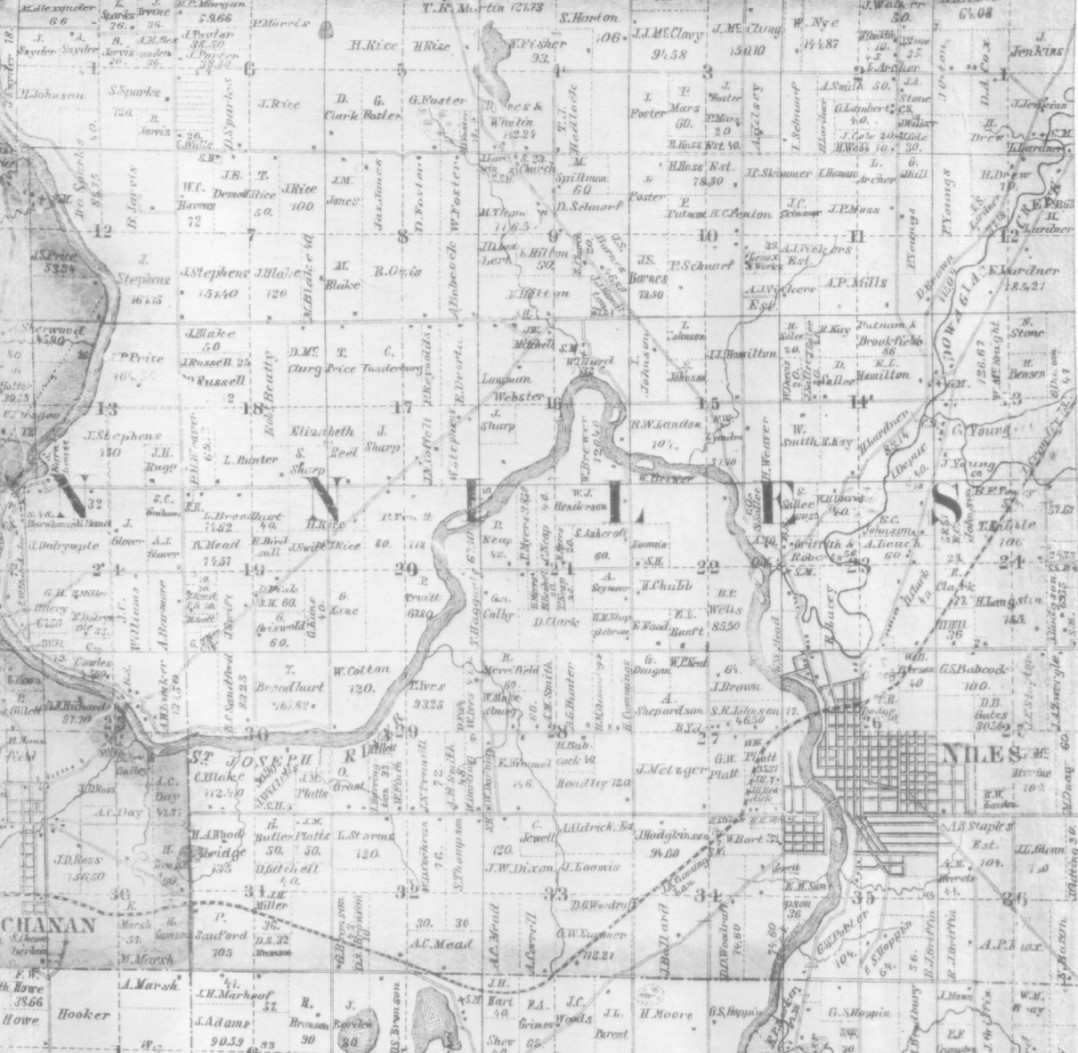
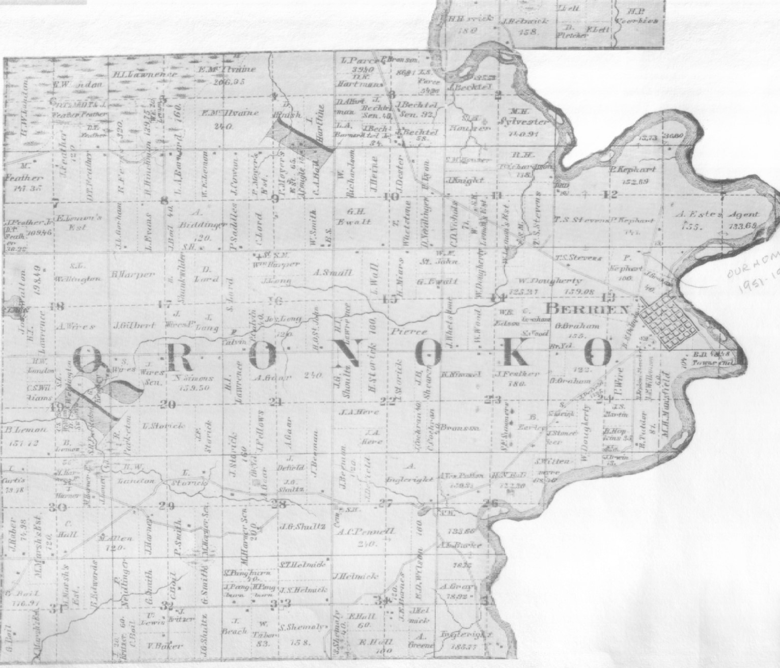
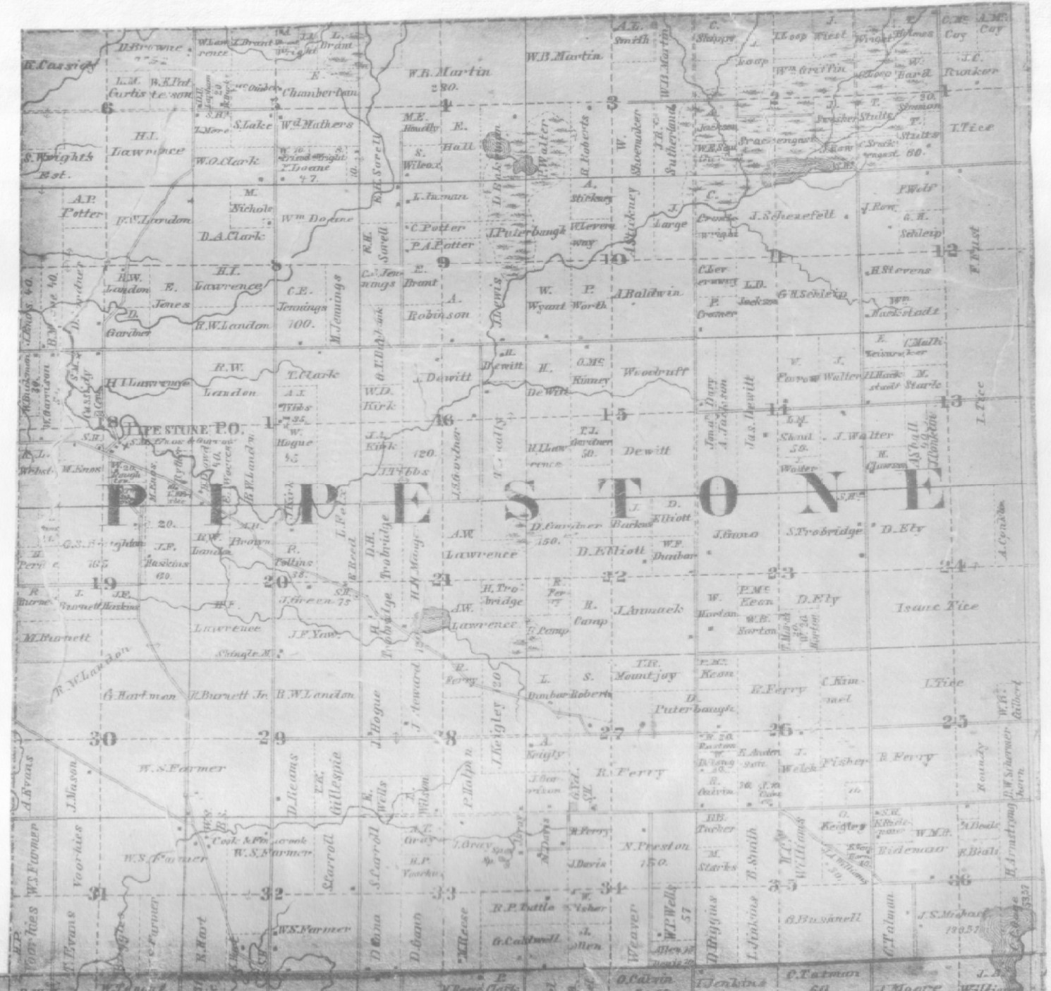
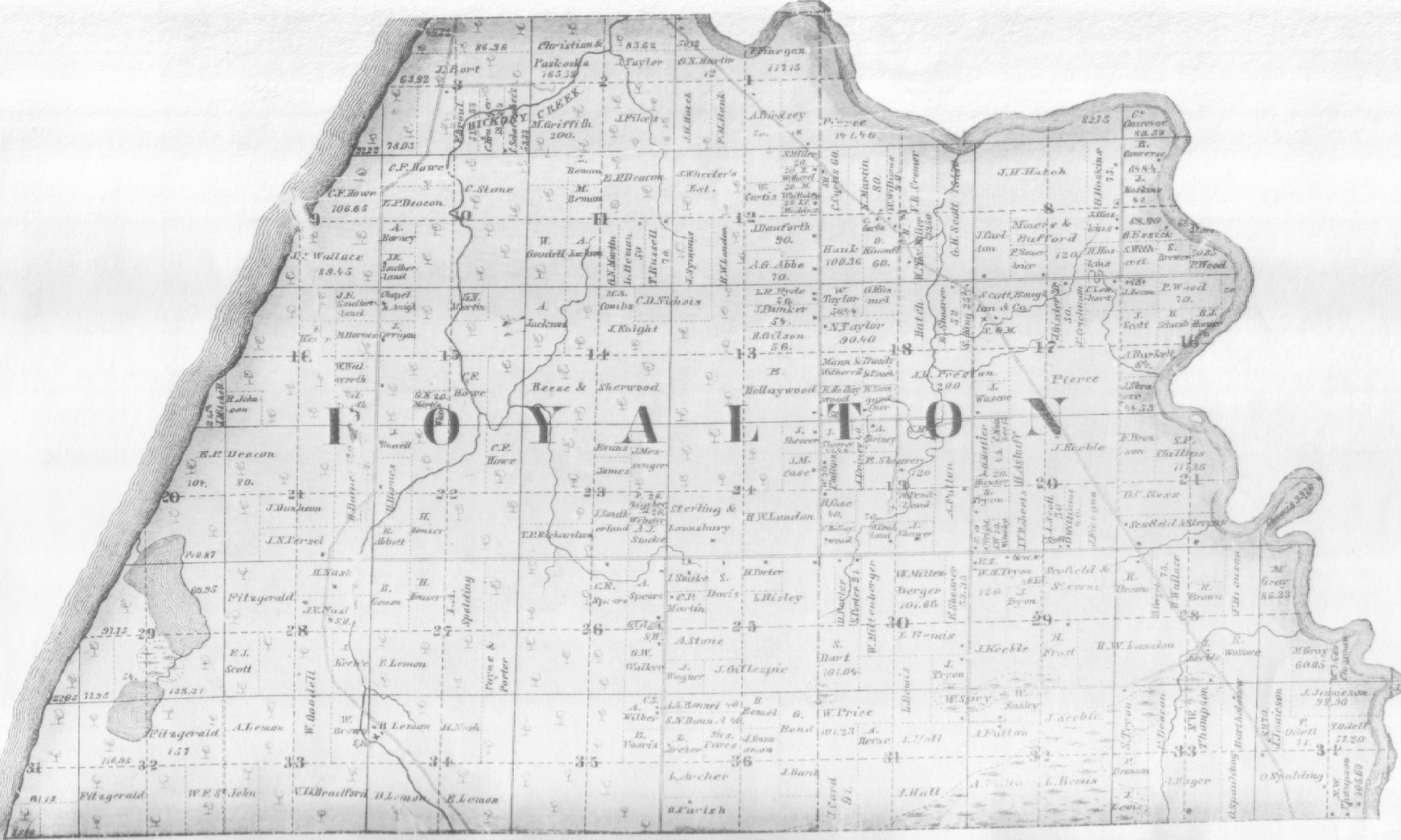
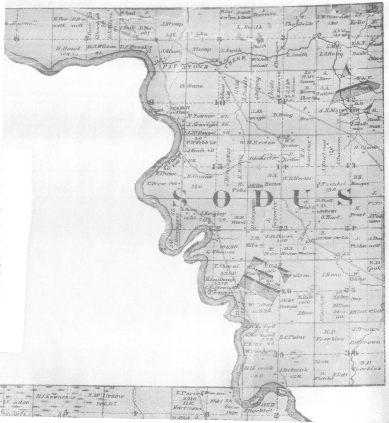
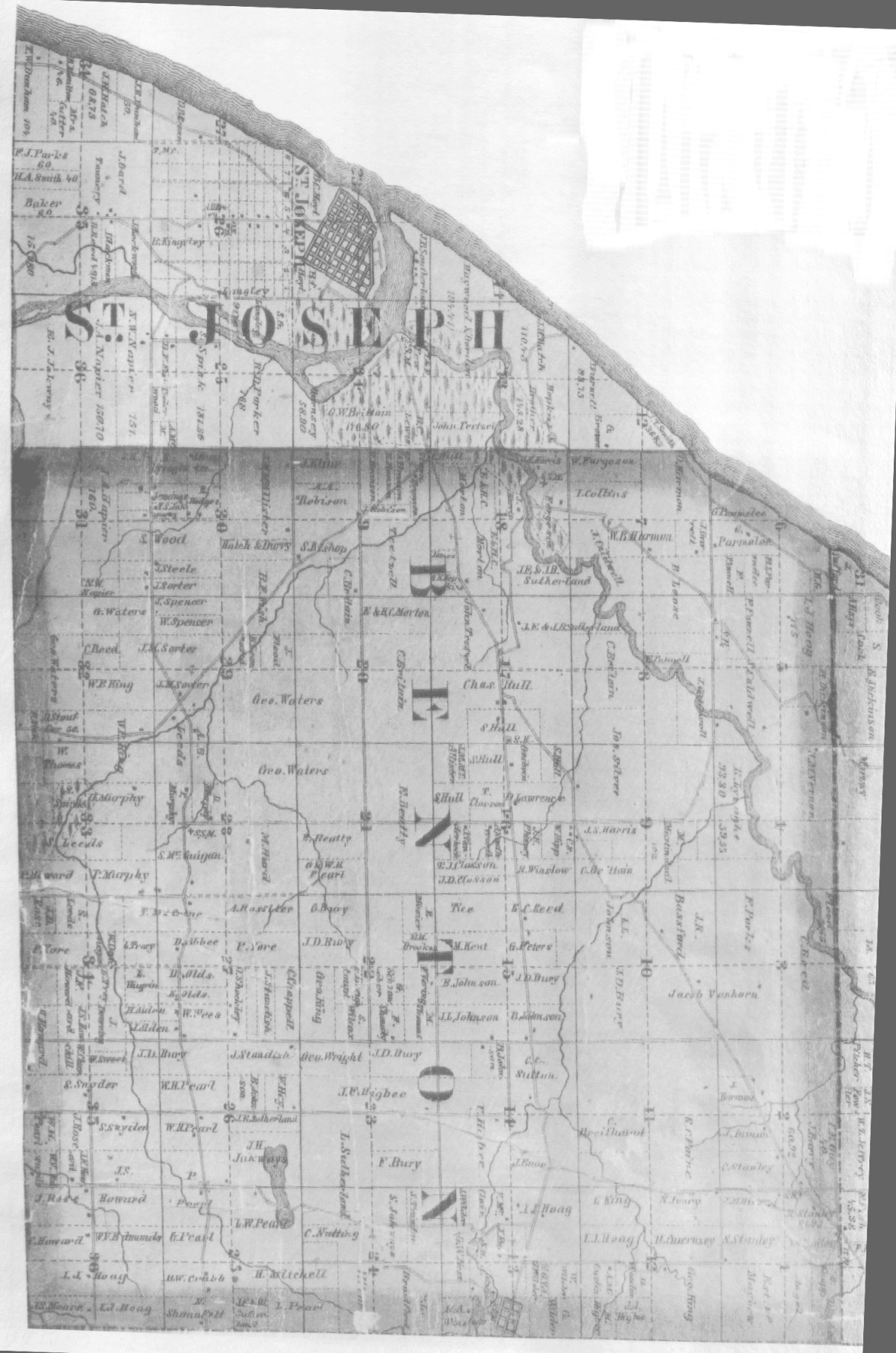
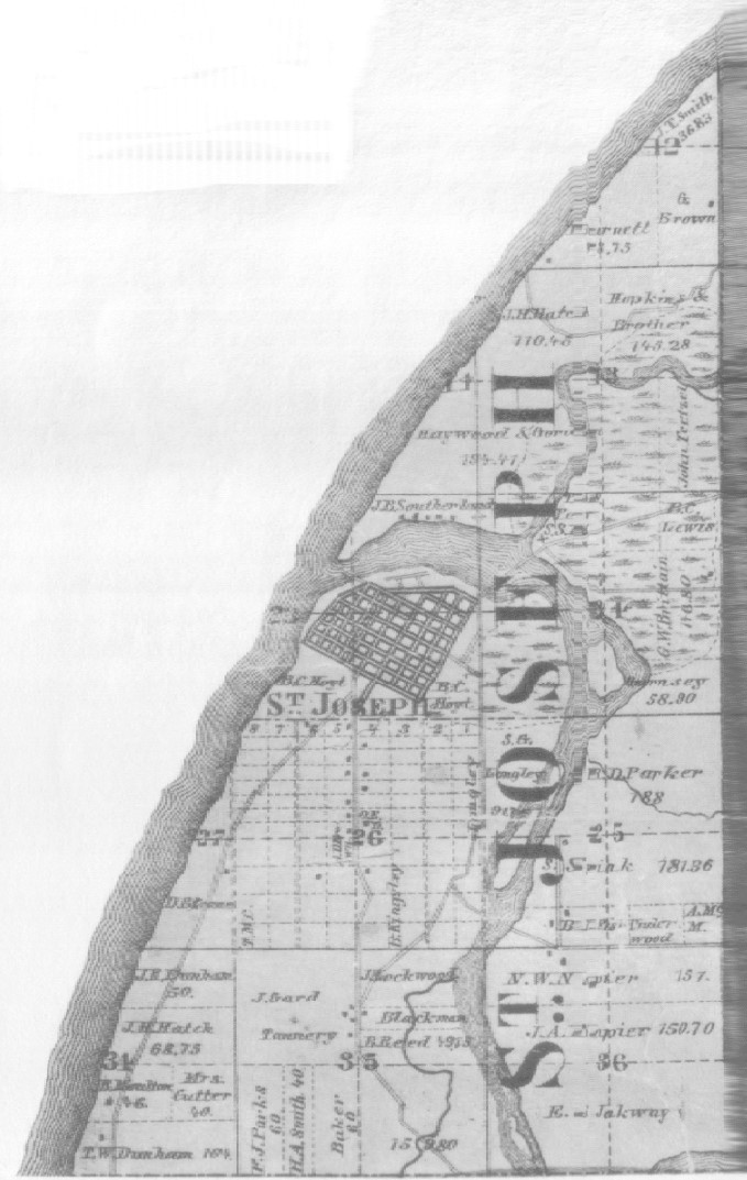
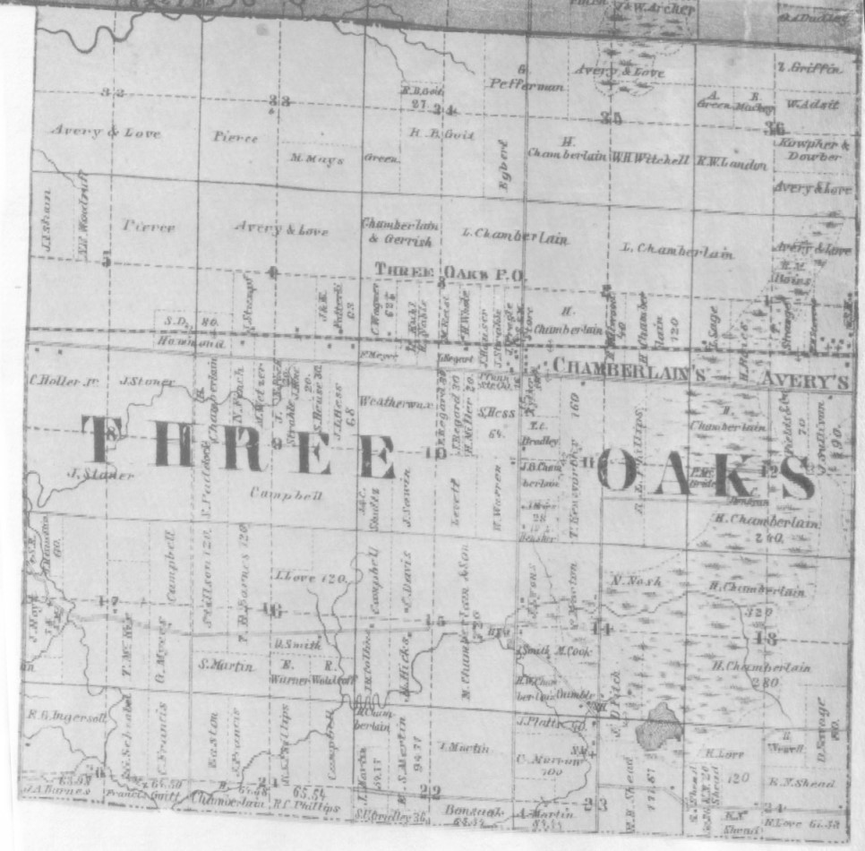
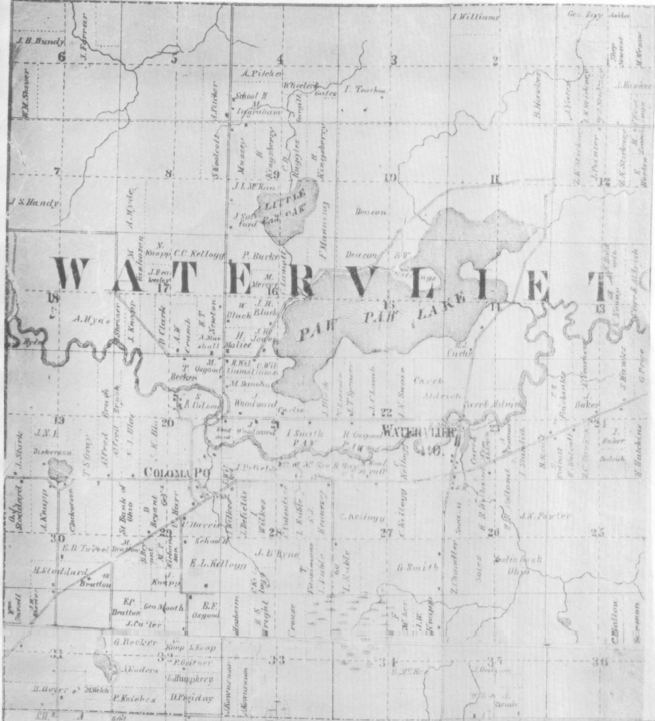
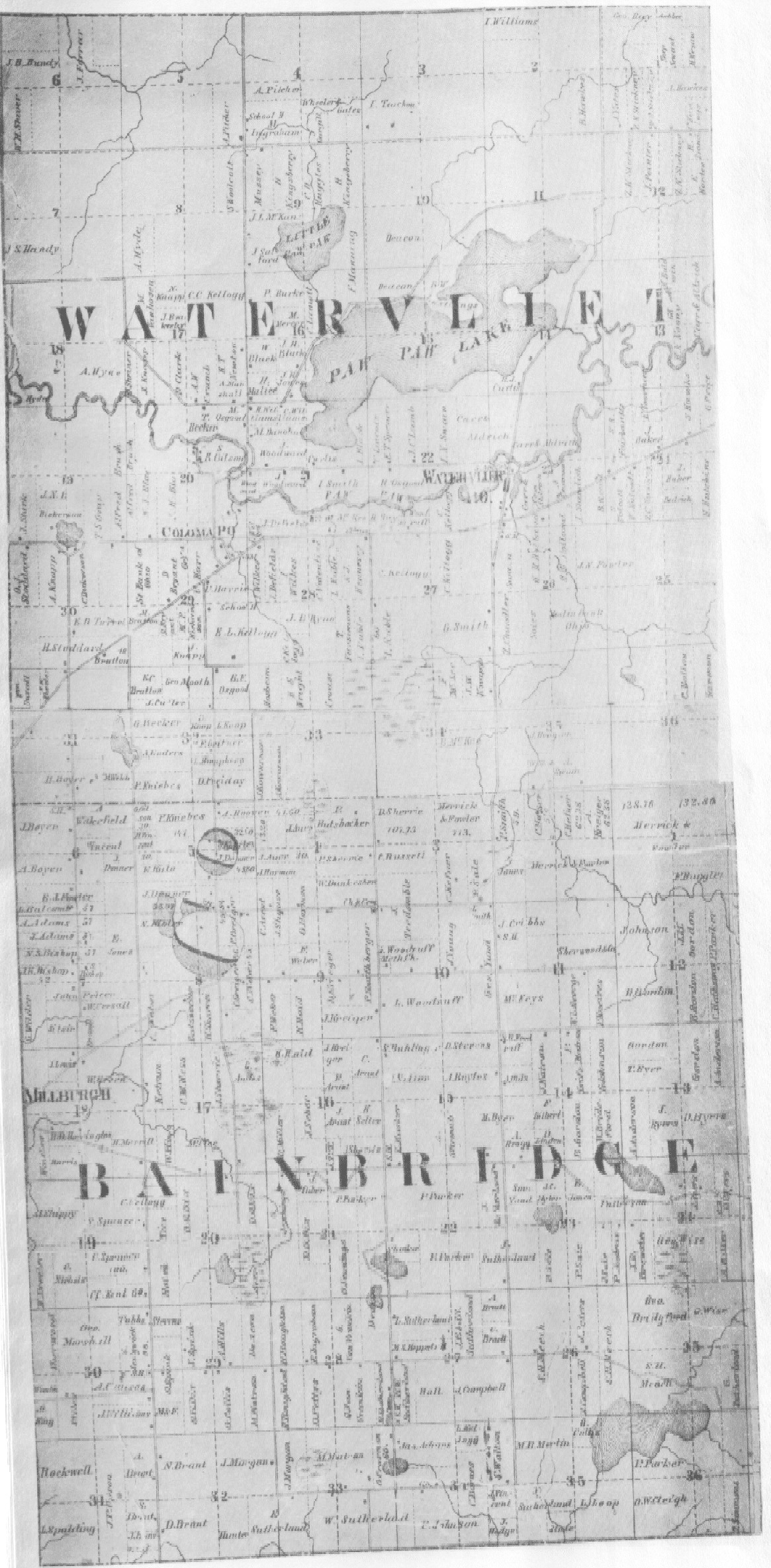
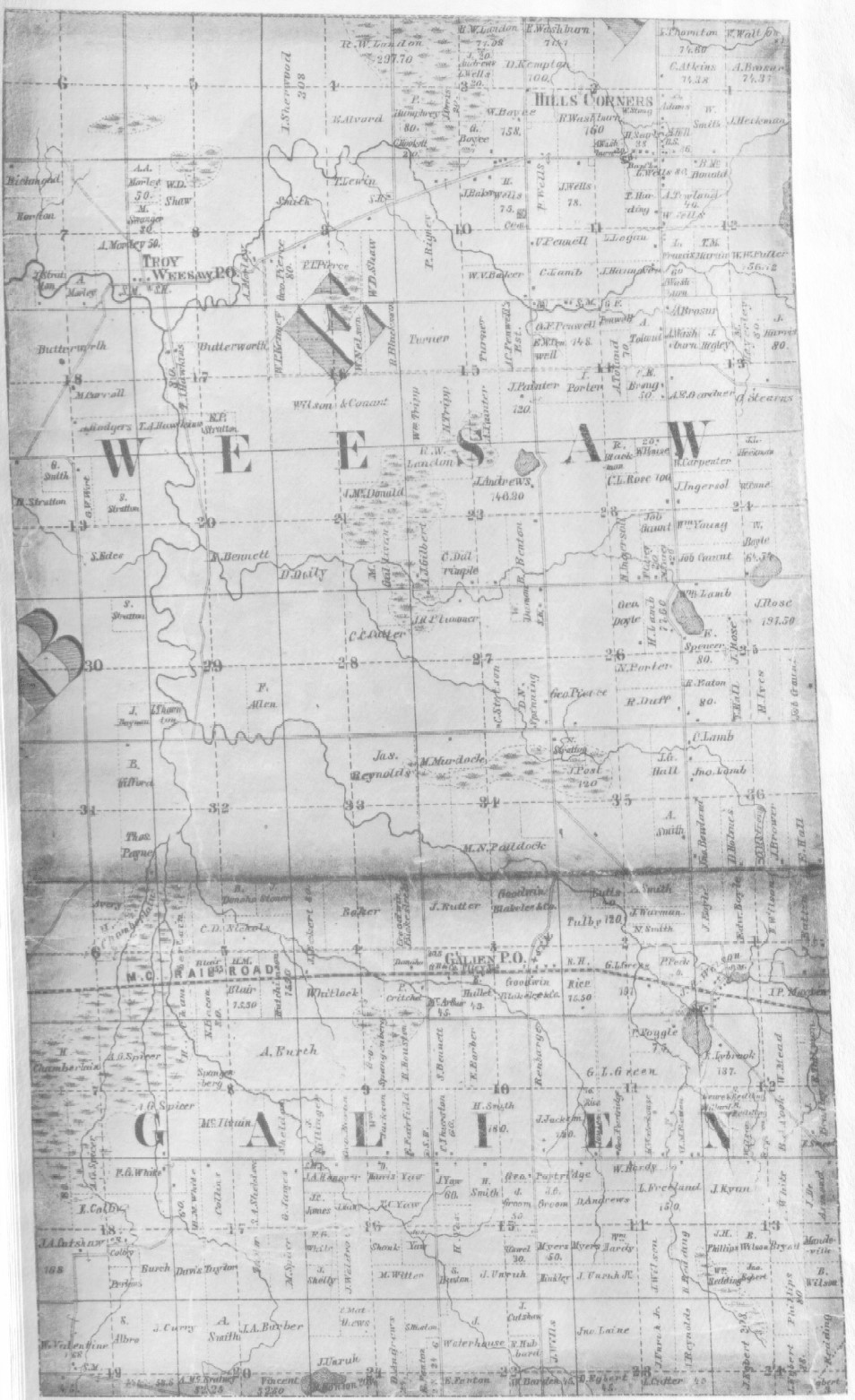
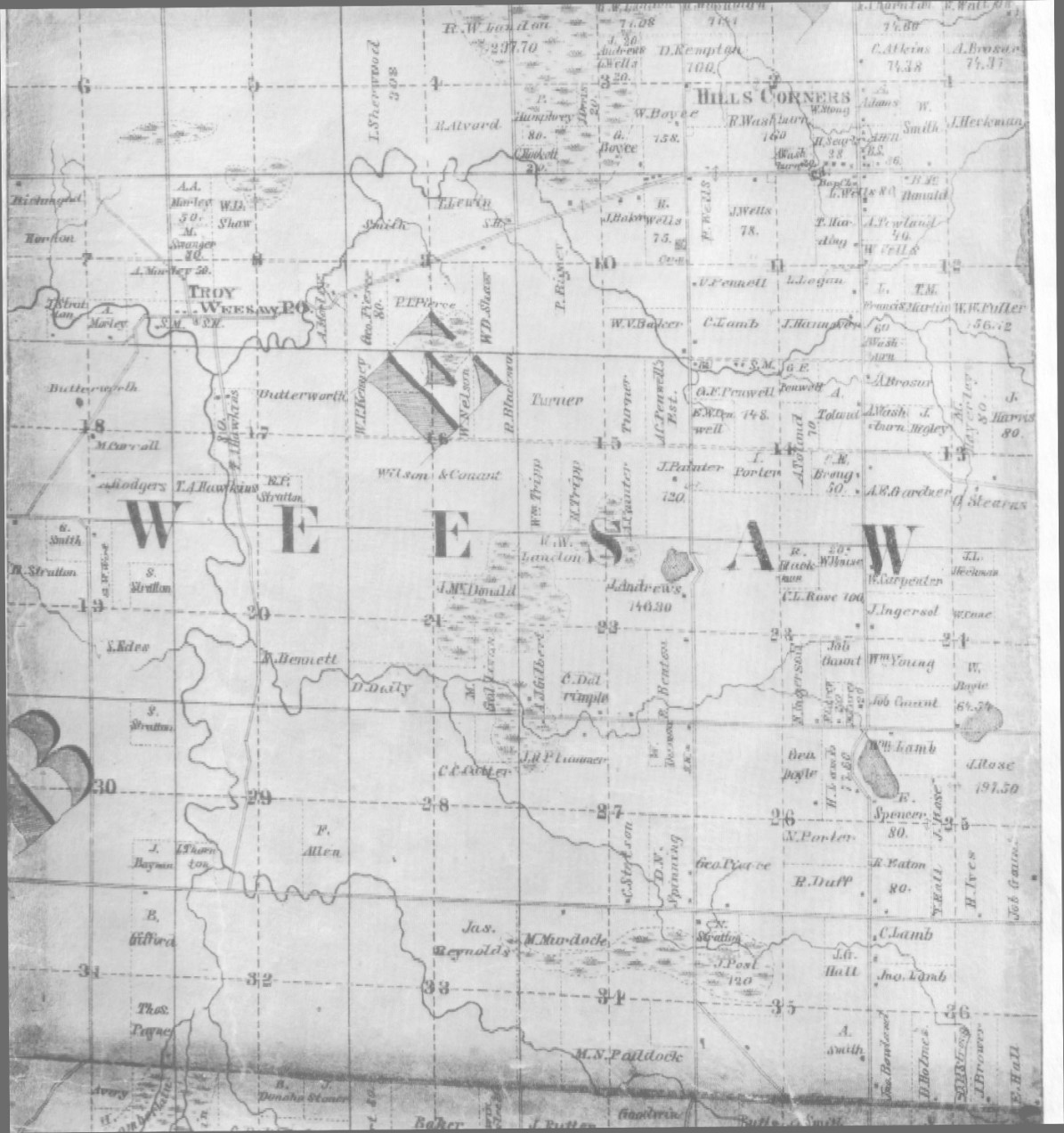
1860 Berrien County Maps & TownsThe following maps were donated to this site by Davis 'C' Ball and scanned for the website by Deanna Branson West. They are reprints of a Tri-County wall Map, published by Geil, Harley and Siverd in Philadelphia in the year1860. We have attempted to present to our viewers the best scan that we could accomplish with a grandfathered print. Location of Property Owners & Businesses |
|||
| A | B | C | D |
| E | F | G | H |
| I | J | K | L |
| M | N | O | P |
| Q | R | S | T |
| U | V | W | XYZ |
County Maps |
|||
Bainbridge Township |
Niles Township |
||
|
It should be noted that some changes have been made in Berrien County since the printing of the 1860 maps:
In showing these maps of the previous township divisions, it will help researchers understand that even though a family might not have moved, sometimes when townships boundaries changed, the resident might then be in a totally different township. | |||