|
|
Early History The area T8N-R12E, now known as Goodland Township, was originally part of Lapeer Township, formed 30 Dec 1834. On 25 Mar 1850, T8N-R12E was joined with T7N-R12E to form Imlay Township. Then on 12 Feb 1855, Imlay was split, with T8N-R12E becoming Goodland Township, and T7N-R12E retaining the name Imlay Township. Several parcels of land in T8N-R12E were purchased by speculators, as early as 1836, but no settlers came until 1851. The first settler was James HILLS in section 29, with a land entry on March 17, 1851. He didn't stay long, but others soon followed, and by 1874 the population had reached 920. The farmland was excellent, except for the large areas of swamp and marsh around Mill Creek, which flows southwest through the township. No communites have formed in the township, with the possible exception of a small, unincorporated community called Goodland. [HRP, pp. 174-9] | |||||||||||||||||||||||||||||||||||||||||||||||||||

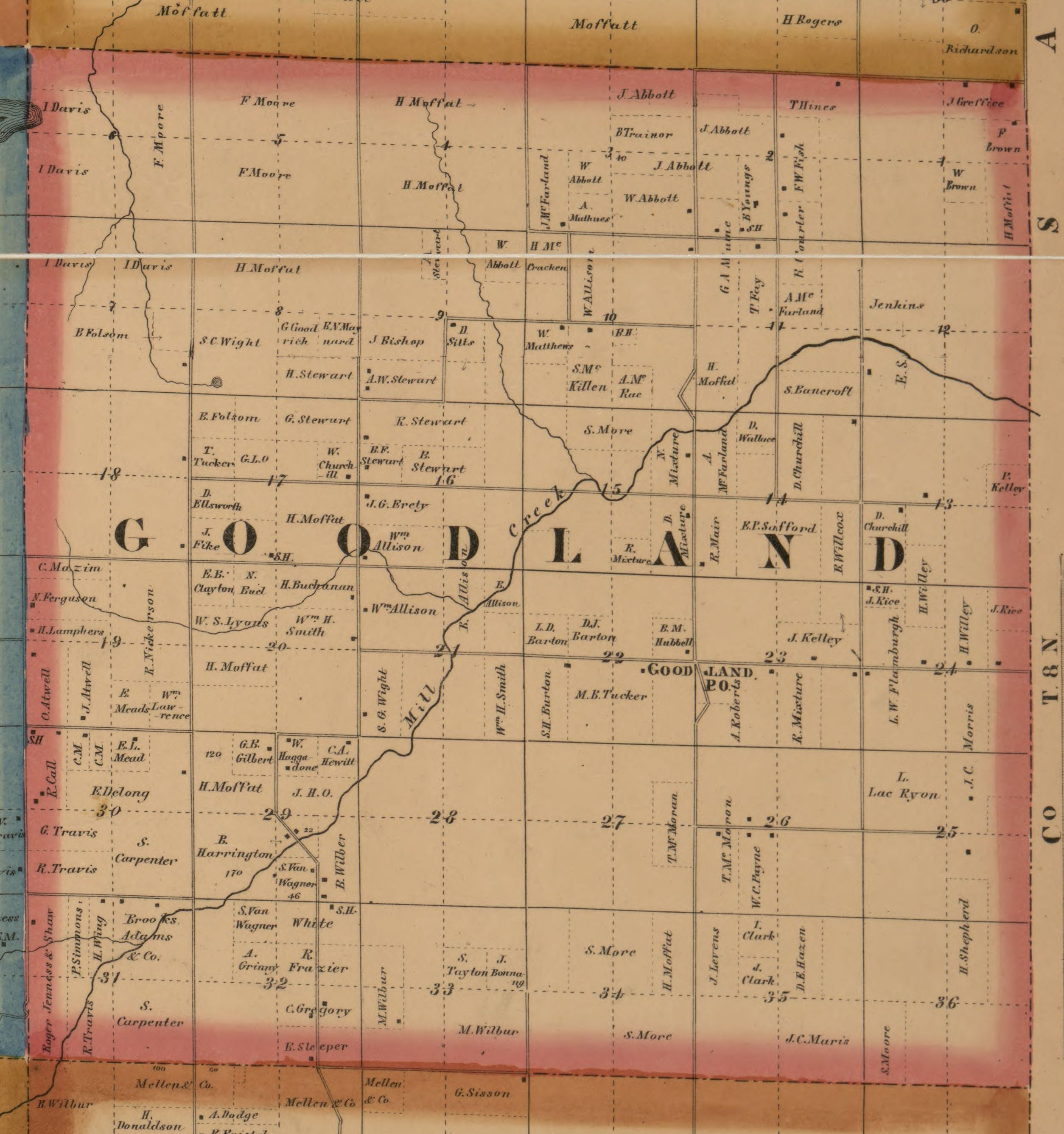
1863 map of Goodland Township (T8N-R12E) cropped from the 1863 map of Lapeer County. Click for a larger image. [MLC] 1863 Directory for Goodland Township, from [MLC].

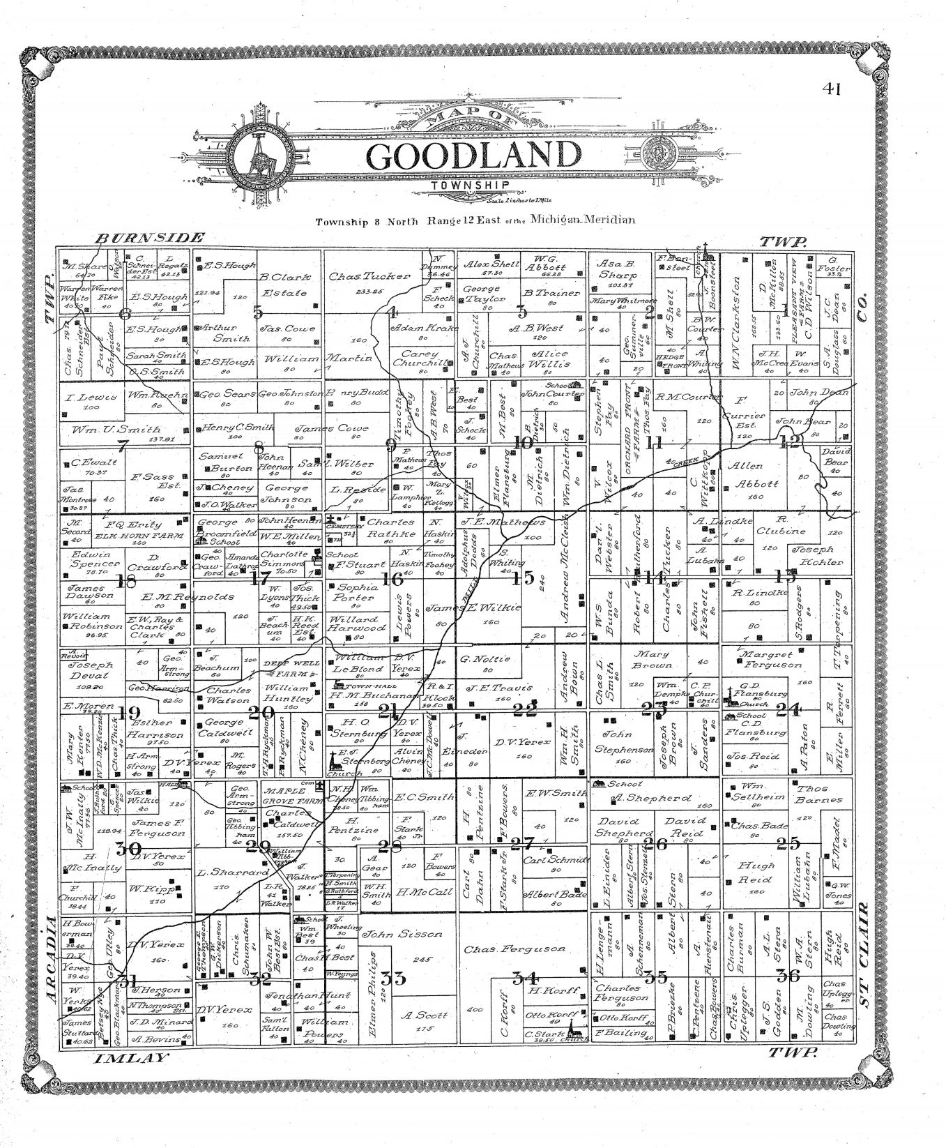
1906 map of Goodland Township (T8N-R12E) from the 1906 Atlas of Lapeer County. Click for a larger image. | |||||||||||||||||||||||||||||||||||||||||||||||||||
|
[MLC] 1863 Map of Lapeer County includes names of property and business owners. Wikipedia page on Goodland Township Names of property owners can be seen on the 1863, 1874, 1893, 1906 and 1921 plat maps. See the Maps page for links to these. Back to History of Each Township and Village in Lapeer County, MI |
|
This page was last revised 18 Mar 2025 by William Haloupek.
Lapeer County MIGenWeb contents have been willed to MIGenWeb. |

