|
Lapeer County, MI
1863
Map of Lapeer County includes names of property and business owners. 20 Mb.
1874
Atlas of Lapeer Co., Michigan, ed. F. W. Beers.
1884
History of Lapeer County, Michigan : with illustrations and
biographical sketches of some of its prominent men and pioneers
(1884) by H. R. Page Includes a county map (below) but no
township maps.
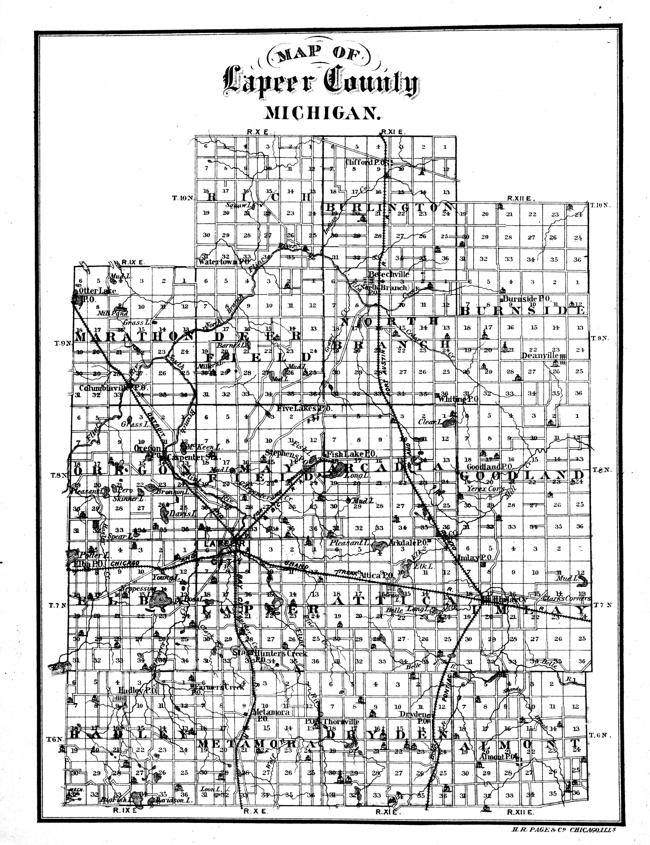
1884 map of
Lapeer County, from the History of Lapeer County, p. 8. Click for
a larger image.
1893
Atlas and Directory of Lapeer County, F. A. Dunham et al,
includes names of property owners and has an extensive directory.
Also downloadable at
archive.org.

1893 map of Lapeer County, from the Atlas.
Click for a larger image.
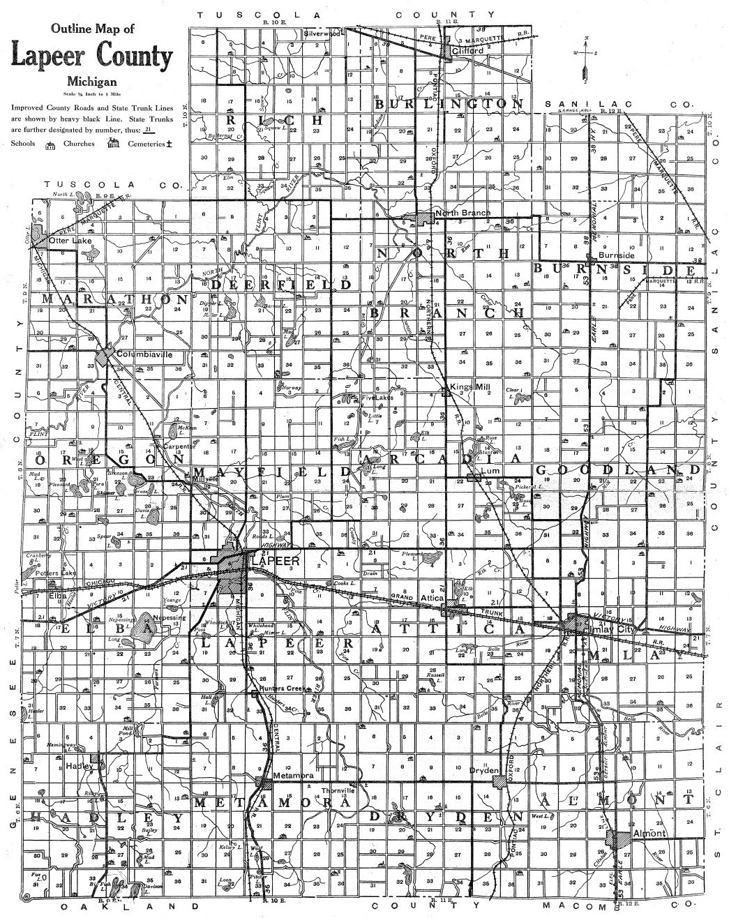
1906 Standard atlas of Lapeer County, Michigan
1921
Atlas and Plat Book of Lapeer County, Michigan
1921 map of Lapeer County, from the Atlas.
Click for a larger image.
|