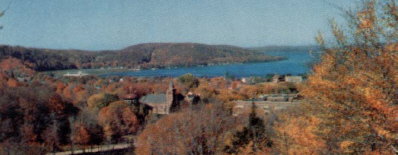
In the calm bays of Grand Marais,
Munising and Grand Island early Ojibway or Chippewa Indians found fine camping
grounds well sheltered from gales that rush in from the north. Those early inhabitants existed primarily on hunting and fishing with a little agriculture.
Alger County's history appears
to center a great deal on the Pictured Rocks area. However, it was never a
major center of Indian activities. The rugged and inhospitable coast prevented
easy access by water and a lack of ready food sources inland precluded permanent
settlement.
Early English-speaking
explorers named the cliffs the "Pictured Rocks" for the multitude of colors and
patterns on their facades. The Rocks did have some minor religious
significance to the Indians and they called the area Ishpabecca, meaning "high
rocks." As was common in aboriginal cultures, they attached religious
significance to inanimate objects. Thus the rocks and caves of the cliffs were
personified as devils, ghosts, etc. Certainly many of the stories grew as the
newly arriving Europeans embellished the original Indian legends. Many of these
tales are retold in Beatrice Castle's book Grand Island Story.
Prior to the first white settlers, fur traders
and fishermen explored the area. It isn't certain who the first
Europeans to see the land that is today called Alger County, but it could have been the French
explorers Etienne Brule and a man known to history only as Grenoble. Some time
around 1622 the intrepid pair reached a previously unknown lake above Huron,
Lake Superior, but what they saw was ill-recorded.
The first Europeans
definitely known to have explored the Alger County area were the legendary
French voyager Pierre Esprit Radisson with his brother-in-law, Medard Chouart Sieur des Groseilliers,
in 1659. The pair were searching for new sources of fur, an effort that reaped
them tremendous reward.
Other famous men also coasted
the area. In 1660, Jesuit priest Rene Menard passed with Jesuit Claude Allouez
following in 1664. Jacques Marquette, another old Jesuit, passed in 1669 en
route to his La Pointe mission.
Curiously, the French rejected
the discovery of the seemingly limitless bounty of Superior, leading Radisson to
join the British and help to found the famous Hudson's Bay Company. It's not
unlikely that the two travelers camped somewhere along the coast
between Grand Marais and Au Train. The great fleets of voyageurs that later
followed certainly did. By 1668 the French were well familiar with Superior's
south shore and considered all of it part of New France. With the Peace of Paris
in 1763 the area was ceded to the British, and in 1783 the region became part of
the fledgling United States.
The American Fur Company built a post on Grand
Island in the mid 1820's. Most of Alger county land was included in the transfer
of lands by the Chippewa to the US Government in 1836.
Alger County was settled in the
mid-1800s as a booming area for iron and lumber mining however, it now relies on
a different natural resource ~ its scenic Lake Superior shoreline in the
northern Upper Peninsula. Alger became a county on March 17, 1885 and got
its name from Russell Alger, Governor of Michigan from 1885-86.
Today forest-related industries are still a major
part of Alger county. Although noted mostly for tourism other industries include
farming, dairying, sand and gravel. The Hiawatha National Forest comprises most
of the County, which include many waterfalls, trout streams and inland lakes.


