Arenac Co Maps
The Public Land Survey System (PLSS), also referred to as the Rectangular Survey System, is the surveying method used to draw property lines in the US for newly sold or settled land upon France ceding lands known as the Louisiana Purchase. Although PLSS has been the primary US survey method since 1785, there are several exceptions, and Michigan contains some of them. This earlier methods are “long lots” that ensure access to a main transport route along a waterway. These plots are French settlement regions prior 1785 along the Detroit and St. Clair rivers, plus some places near Sault Ste. Marie, Marquette, and Ypsilanti. For more information Michigan land survey systems, see the links in the Land Survey Systems section of online resources listed below.
Using maps for genealogy
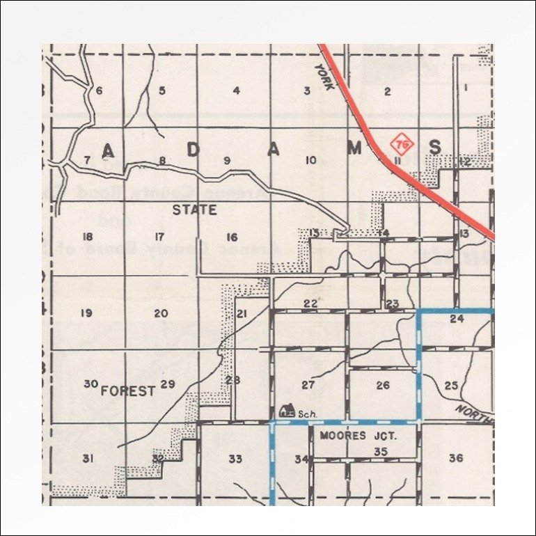
In Michigan, a township is a subdivision of a county consisting of 36 sections arranged in a 6 by 6 square, measuring 6 miles by 6 miles (see this page, image 5 of 1955 Adams Twp sections). These measured-out units are referred to as “Congressional townships” because they are created by an act of the state.
A general law township is the area under the management of a local governing body with its own elected officials, and may cover more or less than 36 square miles. A charter township is a special classification created by the 1947 Michigan Legislature to provide greater protection against annexation by a city. As of 2026, there are 143-146 Michigan townships considered to be chartered.
Due to natural formations, waterways and coastlines, some counties are not actual rectangles and may end up being quite small.
Congressional townships much less than 36 may be under the jurisdiction of a county next to it, coming under the governance of a “political township.” Arenac County has four township comprised of less than 36 square miles– Lincoln, Sims, Standish and Whitney–but have existed as political townships of themselves, with their own governmental units.
There are two types of townships in Michigan—general law and charter townships. Charter township status is a special township classification created by the Michigan Legislature in 1947 to provide additional powers and streamlined administration for governing a growing community. A primary motivation for townships to adopt the charter form is to provide greater protection against annexation by a city. Currently, 146 Michigan townships have opted to become charter townships.
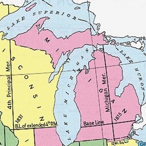
The US Public Land Survey System (USPLSS) recognizes principal meridians as the north-south lines used for surveying large areas of land. These are north-south lines marks used to divide townships between east and west sections. Baselines run east-west and are used as north and south references for defining sections. (Michigan is the only state with two baselines.)
The basic unit the USPLSS of the system is the “section” within a township. One section is–in theory–one piece of land that measures 1 mile by 1 mile square, each containing 640 acres. Within each section, property may be sold as half, quarter or one-sixteenth (“quarter of a quarter”) quarter.
Plat maps (also referred to as cadastral maps) carry letter and number combination notations that describe the location of property within the township:
- R – range lines; north- south lines marking boundaries (measuring E-W of a Principal Meridian
- T – township lines; east-west lines marking township boundaries
- Number: Section numbers begin at the northeast-most section as #1. Numbering proceeds west to #6, then it drops down (south) to run the opposite direction (west) along the bottom of the previous. This switch-back continues until it ends at the south-seat corner as #36.
Translating land descriptions to maps can be frustrating for those new to the concept. If you are following family history through land purchases and sales, you find it helpful to read some of the articles recommended in the land survey systems section below.
Another type of cadastral map useful for genealogists is a Sanborn Fire Insurance, drawn up of an urban area. Noting blocks and street numbers, fire insurance maps show the size, shape, and construction of commercial buildings, factories and homes with details about fire walls, windows, doors, roof types, sprinkler and water systems, and fire hydrants. If you have a family history story about a fire, a Sanborn map could give clues to how and why the fire was responded to as it was. Library of Congress maps for Arenac County cover only Standish, for 1895, 1909, 1904 and 1924. (See Sanborn Maps below)
Historical maps on MIGenWeb/Arenac
Arenac County, 1827-1857 (before it was merged with Bay)
This map indicates that early names and boundaries of Michigan counties differ from what they are today.
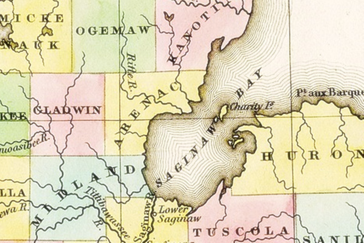
Bay County, 1874 (Arenac was part of Bay from 1857-1883)
The “Railroad map of Michigan prepared for the commissioner of railroads,” by G.W. & C.B. Colton & Co, shows the drainage, cities and towns, and railroads of Michigan at the time. This image of Bay County (the yellow colored section), which at the time included what is now Arenac County, is only a portion of the original railroad map.
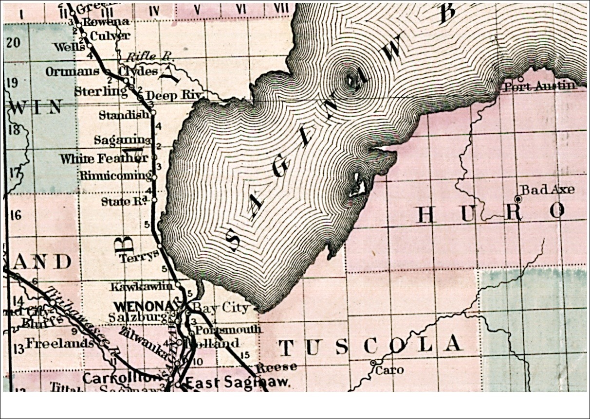
Arenac County, 1885
The “Official map of Michigan, railroad, township and sectional, prepared under the direction of the commissioner of railroads” details drainage, cities and towns, and the railroad network. Arenac was officially created from Bay in 1883. The original published document lists county seat 1884 city census information and miles of railroad track along the upper left side of map. In 1884, Omer was Arenac’s county seat (today it is Standish). Its population was 4032. It states 0 miles of railroad.
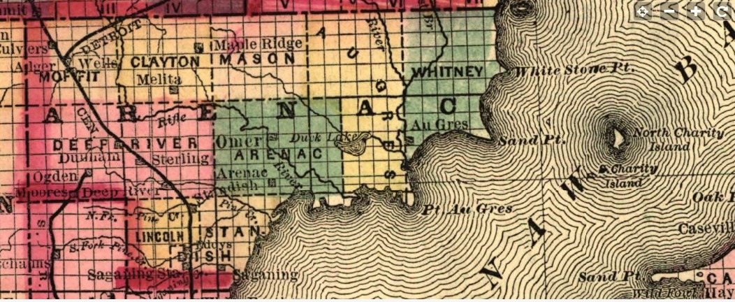
Arenac County, 1906
The following links are to maps from the book Standard atlas of Arenac County, Michigan: including a plat book of the villages, cities and townships of the county compiled and published by Geo. A. Ogle & Co., 1906, reprinted by the Arenac County Historical Society. Digital images linked from this page were contributed by Greg M. Knopp. An index of land owner names on these plats is on ArenacHistory.org. For best viewing, expand the maps to full size and then enlarge.
County
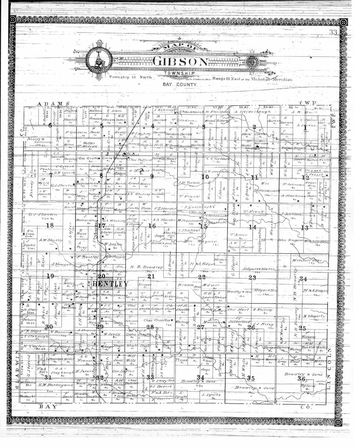
This 1906 Arenac County map shows all the townships’ survey grids. Note that (1) what is today’s Sims Twp appears on the map as part of Whitney Twp and (2) that Gibson Twp (now in Bay Co) was part of Arenac Co in 1906. The loss of Gibson Twp is what created the “boot heel” configuration the county has today. In this atlas, municipalities may not accompany their correct township map; town maps were fitted in where space was available.
Townships in 1906
Adams Twp | Arenac Twp | Au Gres Twp | Clayton Twp | Deep River Twp | Gibson Twp (once part of Arenac Co, now in Bay Co) | Lincoln Twp | Mason Twp | Moffatt Twp | Sims Twp (lower 1/4 of map) | Standish Twp | Turner Twp | Whitney Twp (upper 3/4 of map)
Communities in 1906
Alger | Arenac | Bentley (in Bay Co, Gibson Twp; once part of Arenac Co) | Deep River | Omer | Orr Park | Point Lookout | Standish | Sterling | Turner | Twining | Wallace | Worth
Online resources
Land survey systems
- A History of the Rectangular System @ BLM.gov — this is a large PDF
- Graphical Display of the Federal Township and Range System @ Illinois.Outfitters.com
- Information on How to Read Legal Land Descriptions for Michigan PLSS land @ Michigan.gov
- Legal Land Descriptions in the USA @ Illinois.Outfitters.com
- Long Lots: how they came to be @ Project.Geo.MSU.edu
- Public Land Survey System @ Wikipedia.org
- Three Basic Land Survey Systems @ Content.SchoolInsites.com — this will open into a slide show hosted on View.OfficeApps.Live.com
- US Board on Geographic Names @ USGA.gov
Historical and modern maps
- ca. 1810-1970 Archives of Michigan Map Collection @ Michiganology.org
- 1816-1860 Surveyor Maps @ Michiganology.org
- [1848] Railroads in Michigan, with steamboat routes on the Great Lakes @ LOC.gov
- [1873] Map of Bay County, Michigan @ DavidRumsey.com — when today’s Arenac Co was part of Bay Co
- [1886] Toledo, Ann Arbor, & North Michigan Railway & connecting lines @ LOC.gov
- [1897-98] Galbraith’s MI railway mail service map @ LOC.gov
- [1911] Arenac Co @ MyGenealogyHound.com — shows location of some no longer extant railroad and logging communities
- Bowen’s Michigan State Atlas 1916 — map showing section, T & R lines, railroad & interurban lines, historical sketch, maps of MI, US & world @ UMmich.edu
- [1926-32] Plat book of Arenac County, Michigan @ D.Lib.MSU.edu — township maps showing property owners
- [1955] General highway map, Arenac County, Michigan @ D.Lib.MSU.edu
- [2011] Arenac County Map @ ArenacCRC.org — provided by the county road commission, this is a well-contrasted colored map showing sections, roads, railroads
- Arenac Co Atlases, Maps & Plat Books @ ArenacHistory.org
- [Arenac Co] Maps, Atlases, Illustrations @ HistoricMapWorks.com
- Sanborn Fire Insurance Maps from Standish @ LOC.gov — to understand the maps, see “Interpreting Sanborn Maps” @ LOC.gov
- State & County Maps of Michigan @ MapGeeks.org
Media credits
USGenWeb Notice: In keeping with our policy of providing free information on the Internet, data may be freely used by non-commercial entities, as long as this message remains on all copied material. These electronic pages may NOT be reproduced in any format for profit or presentation by other organizations.
Media Credits
1. MI-WI Meridian-Base Line 1988 Map from U.S. Bureau of Land Management. https://picryl.com/media/usblm-meridian-map-wisconsin-michigan-60af30 : accessed 12 Jun 2023.”G.W. & C.B. Colton & Co. Railroad map of Michigan” prepared for the commissioner of railroads. Philadelphia, 1876. https://www.loc.gov/item/98688498 : accessed 23 June 2023.
2. Wikimedia Commons contributors, “File:1842 A new map of Michigan with its canals roads distances by H.S. Tanner.jpg,” Wikimedia Commons, https://commons.wikimedia.org/w/index.php?title=File:1842_A_new_map_of_Michigan_with_its_canals_roads_distances_by_H.S._Tanner.jpg&oldid=744972310 (accessed June 25, 2023).
3. “G.W. & C.B. Colton & Co. Railroad map of Michigan” prepared for the commissioner of railroads. Philadelphia, 1876. https://www.loc.gov/item/98688498 : accessed 23 June 2023.
4. Cram & Stebbins. Official map of Michigan, railroad, township and sectional, prepared under the direction of the commissioner of railroads. Chicago, 1885. https://www.loc.gov/item/98688499 : accessed 18 May 2023.
5. Standard Atlas of Arenac County, Michigan including a plat book of the Villages, Cites and Townships of the County, compiled by Geo. A. Ogle & Co., Chicago, 1906; p 22. Image courtesy of Greg Knopp.
USGenWeb Notice: In keeping with our policy of providing free information on the Internet, data may be freely used by non-commercial entities, as long as this message remains on all copied material. These electronic pages may NOT be reproduced in any format for profit or presentation by other organizations.