Alger Cemetery (aka Moffatt Township Cemetery)
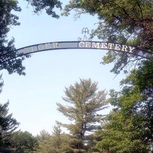
Alger Cemetery lies within a wooded area in Moffatt Township Section 21, between I-75 and M-76. From Alger, travel southeast on M-76/Old M-76. On the right will be a dirt road without a street sign (sort of across from Oasis Lake Park) where you should see a RR sign a few feet down that dirt road. Turn right onto that road, go over the railroad tracks and you will quickly come to the cemetery on the right side of the road. The closest village is Alger. Standish is 13 to 17 miles south of Alger, depending on what road you take.
Earliest birth 1837, earliest death 1894.
Contact Alger Cemetery
GPS coordinates for Alger Cemetery: 44.115438, -84.116780
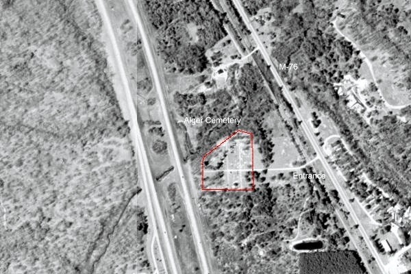
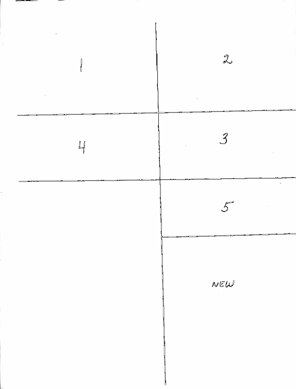
Alger Cemetery burial index
Barringer’s Arenac County Michigan Cemetery Inscriptions index searchable table
The Barringer, et al inscriptions index table contents were contributed in 2005 for MIGenWeb use by Betty Brokoff Barringer and “the Cemetery Club” members Carlie Welker Klumpp, Barbara Briggs Foster and JoEllyn Lawson Pedota, from the book Arenac County Michigan Cemetery Inscriptions.3
The burial information provided may be name, section and row location, dates, and inscription. NOTE that the source for this index did not have entries for Section 2 Row 7. When using the Alger Cemetery map, read north to south starting with the northwest corner. Inscriptions transcribed by Betty Brokoff Barringer and JoEllyn Lawson Pedota.
We’ve modified the Barringer book index format to create a searchable table. The compiler retains all rights. When you see “same stone,” this means two or more inscriptions share that stone. If you see “same stone” for your individual, look at the alphanumeric code in the left column, sort the page by the Index order column, and then look for that individual’s number to find who else is associated with that stone. You may find important information (like marriage dates and relationships) about that person when you see what is inscribed about others who share that stone. You can more clearly see the shared stone and burial juxtapostions on our PDF of the Barringer book burial index that appeared on the old MIGenWeb site.
Alger Cemetery contributor submissions
PDF of Alger Cemetery contributor submissions, last updated in 2017.
Do you have an ancestor’s cemetery information you’d be willing to share? These contributor comments often provide detail directly from the family that may lead a researcher to more resources. The submissions usually don’t cite cemetery section & row location, nor do they commonly cite a verifiable source. Still, it provides one more possible clue to a genealogical solution. Let the MiGenWeb/Arenac coordinator know if you have something to contribute.
Online resources
- Alger Cemetery @ BillionGraves.com
- Alger Cemetery @ FindAGrave.com
- Alger Cemetery Topo Map @ AnyplaceAmerica.com
- Alger Cemetery tombstone photos & transcriptions @ MIGenWeb.org
- Arenac County, MI Alger Cemetery (aka Moffitt Township Cemetery) @ GenealogyTrails.com
Media Credit
1. Aerial view Alger Cemetery GPS approximately 44.115438, -84.116780. Date unknown. Photo source USGS
2. From Arenac County Michigan Cemetery Inscriptions, Betty Barringer, compiler (Standish, 1992). Used with authors permission (2005) for use on MIGenWeb/Arenac.
3. Ibid, pp 157-176.
USGenWeb Notice: In keeping with our policy of providing free information on the Internet, data may be freely used by non-commercial entities, as long as this message remains on all copied material. These electronic pages may NOT be reproduced in any format for profit or presentation by other organizations.